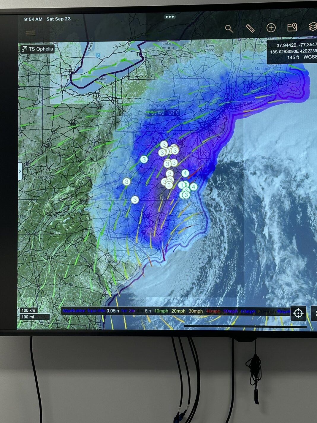
Tropical Storm Ophelia is moving northward along the U.S. east coast, bringing the threat of storm surge, hurricane-force winds and heavy rainfall to portions of the southeastern and mid-Atlantic states. The National Hurricane Center (NHC) issued a Hurricane Watch for parts of eastern North Carolina and southeastern Virginia, where hurricane conditions are possible early this morning. A Tropical Storm Warning is in effect for a larger area, from Cape Fear, North Carolina, to Sandy Hook, New Jersey, including Pamlico and Albemarle Sounds, Chesapeake Bay south of North Beach, Delaware Bay south of Slaughter Beach, and Long Island and Long Island Sound.
According to the latest NHC advisory, Ophelia was located about 60 miles (95 km) east-northeast of Cape Lookout, North Carolina, or 165 miles (265 km) south-southwest of Norfolk, Virginia, as of 5:00 AM EDT on Saturday, September 23, 2023. The storm had maximum sustained winds of 70 mph (110 km/h), and was moving north-northwest at 9 mph (15 km/h). Ophelia is expected to turn northward later today and northeastward on Sunday, moving parallel to the coast before moving away from the U.S. on Monday.
The NHC warned that Ophelia could produce life-threatening storm surge inundation over portions of eastern North Carolina and southeastern Virginia, including Pamlico and Albemarle Sounds, the Neuse and Pamlico Rivers, the lower James River, and the lower Chesapeake Bay. Storm Surge Warnings are in place for these areas, where water levels could reach 2 to 4 feet above ground level within the next few hours. Residents in these areas should follow advice given by local officials and evacuate if ordered.
Ophelia is also expected to bring tropical storm conditions to parts of the coast within the Tropical Storm Warning area through tonight. Hurricane conditions are possible within the Hurricane Watch area early this morning. Wind gusts could reach up to 85 mph (140 km/h) near the center of Ophelia. These winds could cause damage to roofs, siding, trees and power lines. Power outages and coastal flooding are likely in some areas.
In addition, Ophelia could dump heavy rainfall across portions of the Mid-Atlantic states from North Carolina to New Jersey through Sunday. The NHC forecasted that Ophelia could produce total rainfall accumulations of 3 to 6 inches, with isolated maximum amounts of 10 inches. This rainfall may cause flash flooding and urban flooding impacts in some areas.
Furthermore, Ophelia is generating large swells that are affecting much of the U.S. east coast. These swells are likely to cause life-threatening surf and rip currents along the beaches. The NHC advised people to avoid the water and stay away from the shore until the storm passes.
Ophelia is the 15th named storm of the 2023 Atlantic hurricane season, which has been very active so far. Ophelia is also the fourth tropical cyclone to affect the U.S. this year, after Hurricane Nora in August, Hurricane Paul in September, and Tropical Storm Quinn earlier this month. The NHC urged people to monitor the progress of Ophelia and heed any warnings or advisories issued by local authorities.
A global media for the latest news, entertainment, music fashion, and more.


