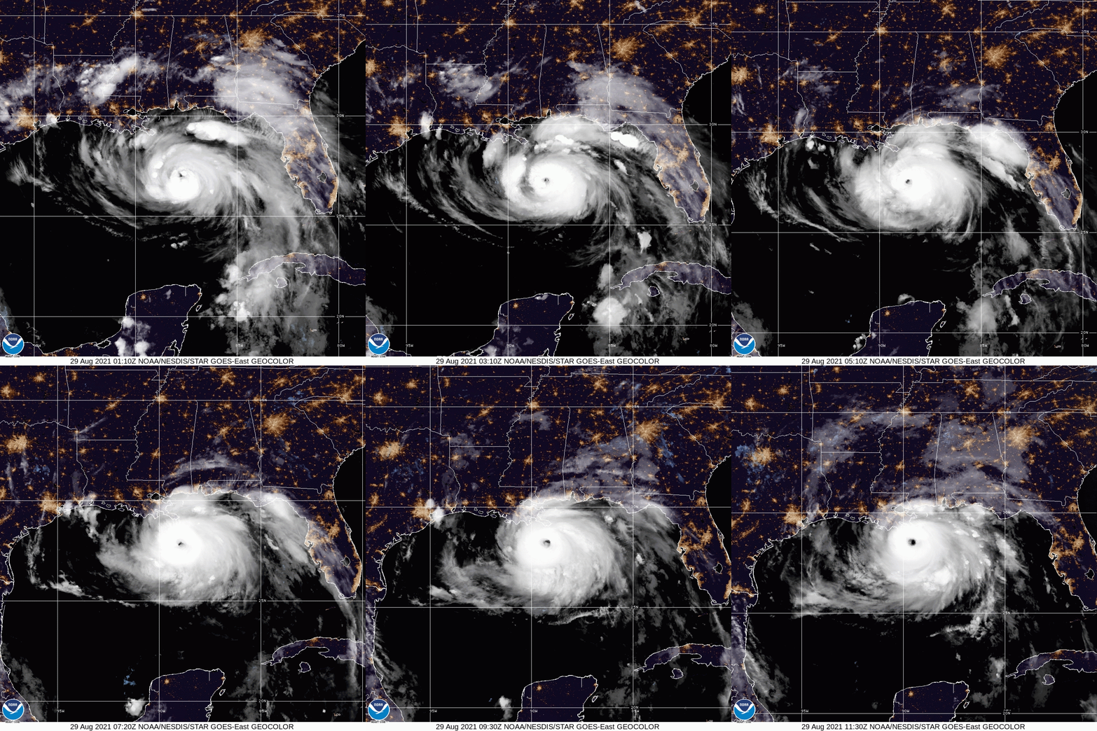
Hurricane Ida, an “extremely dangerous” major hurricane Category 4 approaching the northern gulf coast. Max sustained winds are 145 MPH. This system is expected to continue northwestward with a turn to the north northwest later Sunday morning, the National Hurricane Center (NHC) said Sunday.
Hurricane Ida is expected to make landfall on the southeast Louisiana coast Sunday as a dangerous Category 4 storm, NHC said.
With top sustained winds of 150 mph, Ida was located about 50 miles southwest of the mouth of the Mississippi River, the NHC said in an advisory.
At 700 AM CDT, the National Hurricane Center Issues Hurricane Ida Public Advisory:
As of 7:00 AM CDT Sun Aug 29 the center of Ida was located near 28.5, -89.6 with movement NW at 15 mph. The minimum central pressure was 933 mb with maximum sustained winds of about 150 mph.
“LIFE-THREATENING STORM SURGE AND HURRICANE-FORCE WINDS REACHING
THE COAST OF SOUTHEASTERN LOUISIANA…
…EXTREMELY DANGEROUS CATEGORY 4 HURRICANE IDA EXPECTED TO MAKE
LANDFALL IN SOUTHEASTERN LOUISIANA IN THE NEXT FEW HOURS…”
As of the 6 am CDT, the National Hurricane Center Atlantic updates Ida’s sustained winds are now 150mph, with a central pressure of 935mb. Reports from a NOAA Hurricane Hunter aircraft indicate that maximum sustained winds have increased to near 150 mph (240 km/h) with higher gusts. The latest minimum central pressure estimated from reconnaissance aircraft data is 935 mb (27.61 in).
An elevated NOAA C-MAN station at Pilot’s Station East near Southwest Pass, Louisiana, recently reported a sustained wind of 82 mph (131 km/h) and a gust to 107 mph (172 km/h). Another NOAA
elevated C-MAN station at Southwest Pass recently reported a sustained wind of 77 mph (124 km/h) and a wind gust of 93 mph (150 km/h).
A tornado watch is now in effect for all of New Orleans. In addition to hurricane winds, tornadoes are possible with Ida, forecasters say.
By Sunday morning, Ida’s outer bands were bringing steady rain to the New Orleans area. National Weather Service forecasters say hurricane-force winds are expected in parts of south Louisiana by Sunday afternoon.
The storm’s rapid approach made a mandatory evacuation of New Orleans impossible, but Mayor LaToya Cantrell urged anyone who could leave town to do so before Saturday night.
A global media for the latest news, entertainment, music fashion, and more.


